Search for Grid Square by Postcode
TQ28
Based in the London English Region.
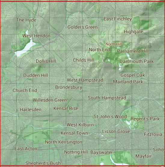
The TQ28 10 square kilometre grid intersects with the settlements of Acton,Alexandra Palace,Archway,Bayswater,Bloomsbury,Brent Cross,Brondesbury,Brondesbury Park,Camden Town,Chalk Farm,Childs Hill,Church End,Colindale,College Park,Cricklewood,Crouch End,Dartmouth Park,Dollis Hill,Euston,Finchley,Fitzrovia,Fortis Green,Golders Green,Gospel Oak,Hampstead,Hampstead Garden Suburb,Harlesden,Hendon,Highgate,Holloway,Hornsey,Islington,Kensal Green,Kensal Rise,Kensal Town,Kensington,Kentish Town,Kilburn,Kings Cross,Kingsbury,Knightsbridge,Lancaster Gate,Leicester Square,Lisson Grove,Little Stanmore,Lower Holloway,Maida Hill,Maida Vale,Maitland Park,Marble Arch,Marylebone,Mayfair,Muswell Hill,Neasden,Notting Hill,Old Oak Common,Oxford Circus,Paddington,Park Royal,Primrose Hill,Regents Park,Saint Johns Wood,Seven Dials,Shepherds Bush,Soho,Somers Town,St Giles,St James,St Pancras,Stonebridge,Swiss Cottage,The Hyde,Tokyington,Tufnell Park,Upper Holloway,Vale of Health,Wembley,West Kilburn,Westbourne Green,Westbourne Park,White City,Whitehall & Willesden.
TQ28
TQ28 is within the post towns of Edgware, Middlesex, London, Middlesex & Wembley, Middlesex.
The square is within Barnet London Boro, Brent London Boro, Camden London Boro, City of Westminster London Boro, Ealing London Boro, Hammersmith and Fulham London Boro, Haringey London Boro, Islington London Boro & Kensington and Chelsea London Boro councils.
The TQ28 national grid square measures 10 km by 10 km and has an area of 1,000 kilometres squared.
The technical term for a 10 km map square is a Hectad.
When this 10 km square is divided into a grid 10 by 10 it gives the next size of grid square. This unit is called a Monad and measures 1km square. 100 monads fit in a 10km square.
Out of the monads generated from square TQ28, 513 are land and -413 are sea. Sea squares are disregarded on this site as they contain no land features.
|
|
|
|
|
|
 |
|
|
|
|
|
 |  |  |  |  |  |  |  |  |  |
 |  |  |  |  |  |  |  |  |  |
 |  |  |  |  |  |  |  |  |  |
 |  |  |  |  |  |  |  |  |  |
 |  |  |  |  |  |  |  |  |  |
 |  |  |  |  |  |  |  |  |  |
 |  |  |  |  |  |  |  |  |  |
 |  |  |  |  |  |  |  |  |  |
 |  |  |  |  |  |  |  |  |  |
 |  |  |  |  |  |  |  |  |  |
| Corner | Latitude | Longitude | Easting | Northing |
|---|---|---|---|---|
| South West Corner | 51.503992 | -0.272338 | 520000 | 180000 |
| South East Corner | 51.503992 | -0.124637 | 530000 | 180000 |
| North West Corner | 51.596076 | -0.272338 | 520000 | 190000 |
| North East Corner | 51.596076 | -0.124637 | 530000 | 190000 |