Search for Grid Square by Postcode
NZ81
Based in the Yorkshire and the Humber English Region.
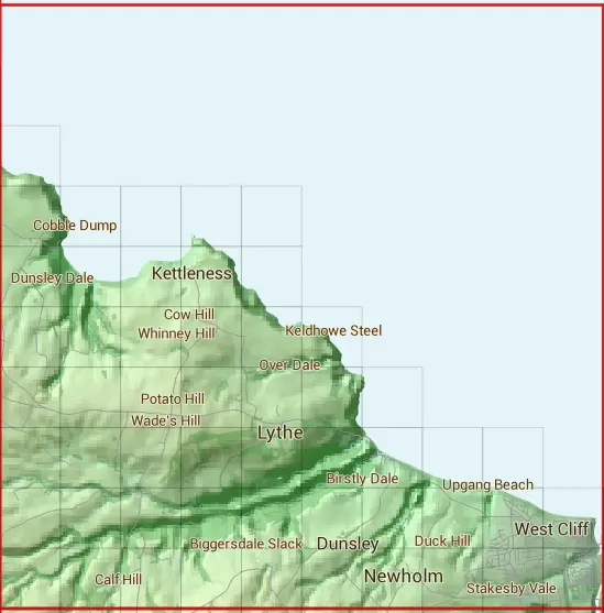
The NZ81 10 square kilometre grid intersects with the settlements of Dunsley,East Barnby,Ellerby,Lythe,Mickleby,Newholm,Runswick Bay,Ruswarp,Sandsend,Ugthorpe & Whitby.
NZ81
NZ81 is within the post towns of Saltburn-by-the-sea, Yorkshire & Whitby, Yorkshire.
The square is within Scarborough District council.
The NZ81 national grid square measures 10 km by 10 km and has an area of 1,000 kilometres squared.
The technical term for a 10 km map square is a Hectad.
When this 10 km square is divided into a grid 10 by 10 it gives the next size of grid square. This unit is called a Monad and measures 1km square. 100 monads fit in a 10km square.
Out of the monads generated from square NZ81, 287 are land and -187 are sea. Sea squares are disregarded on this site as they contain no land features.
|
|
||
|
|
 |
|
|
|
|
|
 | | | | | | | | | |
 | | | | | | | | | |
 |  |  |  |  | | | | | |
 |  |  |  |  | | | | | |
 |  |  |  |  |  | | | | |
 |  |  |  |  |  |  | | | |
 |  |  |  |  |  |  |  |  | |
 |  |  |  |  |  |  |  |  |  |
 |  |  |  |  |  |  |  |  |  |
| Corner | Latitude | Longitude | Easting | Northing |
|---|---|---|---|---|
| South West Corner | 54.477400 | -0.766862 | 480000 | 510000 |
| South East Corner | 54.477400 | -0.609529 | 490000 | 510000 |
| North West Corner | 54.568919 | -0.766862 | 480000 | 520000 |
| North East Corner | 54.568919 | -0.609529 | 490000 | 520000 |