Search for Grid Square by Postcode
NH78
Based in the Highlands and Islands region of Scotland.
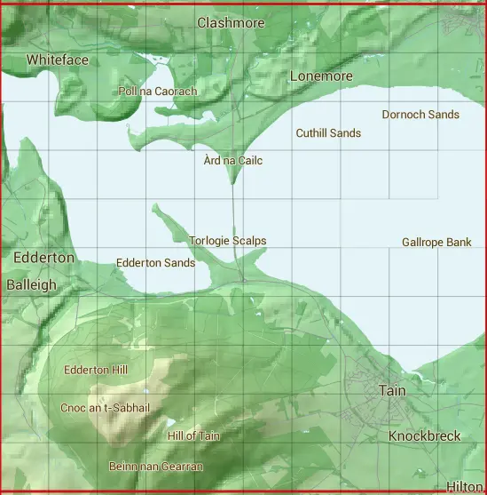
The NH78 10 square kilometre grid intersects with the settlements of Dornoch,Edderton & Tain.
NH78
NH78 is within the post towns of Dornoch, Sutherland & Tain, Ross-shire.
The square is within Highland council.
The NH78 national grid square measures 10 km by 10 km and has an area of 1,000 kilometres squared.
The technical term for a 10 km map square is a Hectad.
When this 10 km square is divided into a grid 10 by 10 it gives the next size of grid square. This unit is called a Monad and measures 1km square. 100 monads fit in a 10km square.
Out of the monads generated from square NH78, 468 are land and -368 are sea. Sea squares are disregarded on this site as they contain no land features.
|
|
|
|
|
|
 |
|
|
|
|
|
 |  |  |  |  |  |  |  |  |  |
 |  |  |  |  |  |  |  |  |  |
 |  |  |  |  |  |  |  |  |  |
 |  |  |  |  |  |  |  |  | |
 |  |  |  |  |  |  | |||
 |  |  |  |  |  |  |  |  |  |
 |  |  |  |  |  |  |  |  |  |
 |  |  |  |  |  |  |  |  |  |
 |  |  |  |  |  |  |  |  |  |
 |  |  |  |  |  |  |  |  |  |
| Corner | Latitude | Longitude | Easting | Northing |
|---|---|---|---|---|
| South West Corner | 57.790693 | -4.193862 | 270000 | 880000 |
| South East Corner | 57.790693 | -4.020325 | 280000 | 880000 |
| North West Corner | 57.883249 | -4.193862 | 270000 | 890000 |
| North East Corner | 57.883249 | -4.020325 | 280000 | 890000 |
1 KM Squares within the NH78 10 KM Square
NH7080 NH7081 NH7082 NH7083 NH7084 NH7085 NH7086 NH7087 NH7088 NH7089 NH7180 NH7181 NH7182 NH7183 NH7184 NH7185 NH7186 NH7187 NH7188 NH7189 NH7280 NH7281 NH7282 NH7283 NH7284 NH7285 NH7286 NH7287 NH7288 NH7289 NH7380 NH7381