Search for Grid Square by Postcode
TQ70
Based in the South East English Region.
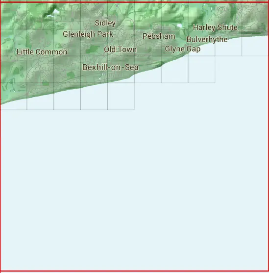
The TQ70 10 square kilometre grid intersects with the settlements of Bexhill-on-Sea & Hastings.
TQ70
TQ70 is within the post towns of Battle, Sussex, Bexhill-on-sea, Sussex, Pevensey, Sussex & St. Leonards-on-sea, Sussex.
The square is within Hastings District, Rother District & Wealden District councils.
The TQ70 national grid square measures 10 km by 10 km and has an area of 1,000 kilometres squared.
The technical term for a 10 km map square is a Hectad.
When this 10 km square is divided into a grid 10 by 10 it gives the next size of grid square. This unit is called a Monad and measures 1km square. 100 monads fit in a 10km square.
Out of the monads generated from square TQ70, 402 are land and -302 are sea. Sea squares are disregarded on this site as they contain no land features.
|
|
|
|
|
|
 |
|
|
|
 |  |  |  |  |  |  |  |  |  |
 |  |  |  |  |  |  |  |  |  |
 |  |  |  |  |  |  |  | ||
 |  |  |  |  | |||||
| Corner | Latitude | Longitude | Easting | Northing |
|---|---|---|---|---|
| South West Corner | 50.771651 | 0.409776 | 570000 | 100000 |
| South East Corner | 50.771651 | 0.556363 | 580000 | 100000 |
| North West Corner | 50.864511 | 0.409776 | 570000 | 110000 |
| North East Corner | 50.864511 | 0.556363 | 580000 | 110000 |