Search for Grid Square by Postcode
TL88
Based in the Eastern English Region.
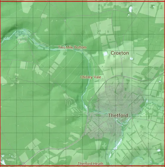
The TL88 10 square kilometre grid intersects with the settlements of Croxton,Elveden,Santon Downham & Thetford.
TL88
TL88 is within the post towns of Brandon, Suffolk & Thetford, Norfolk.
The square is within Breckland District & West Suffolk District councils.
The TL88 national grid square measures 10 km by 10 km and has an area of 1,000 kilometres squared.
The technical term for a 10 km map square is a Hectad.
When this 10 km square is divided into a grid 10 by 10 it gives the next size of grid square. This unit is called a Monad and measures 1km square. 100 monads fit in a 10km square.
Out of the monads generated from square TL88, 1900 are land and -1800 are sea. Sea squares are disregarded on this site as they contain no land features.
|
|
|
|
|
|
 |
|
|
|
|
|
 |  |  |  |  |  |  |  |  |  |
 |  |  |  |  |  |  |  |  |  |
 |  |  |  |  |  |  |  |  |  |
 |  |  |  |  |  |  |  |  |  |
 |  |  |  |  |  |  |  |  |  |
 |  |  |  |  |  |  |  |  |  |
 |  |  |  |  |  |  |  |  |  |
 |  |  |  |  |  |  |  |  |  |
 |  |  |  |  |  |  |  |  |  |
 |  |  |  |  |  |  |  |  |  |
| Corner | Latitude | Longitude | Easting | Northing |
|---|---|---|---|---|
| South West Corner | 52.385076 | 0.643690 | 580000 | 280000 |
| South East Corner | 52.385076 | 0.796133 | 590000 | 280000 |
| North West Corner | 52.478256 | 0.643690 | 580000 | 290000 |
| North East Corner | 52.478256 | 0.796133 | 590000 | 290000 |