Search for Grid Square by Postcode
TL09
Based in the East Midlands English Region & Eastern English Region.
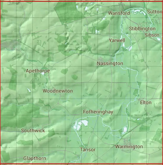
The TL09 10 square kilometre grid intersects with the settlements of Apethorpe,Cotterstock,Elton,Glapthorn,King's Cliffe,Nassington,Southwick,Stibbington,Sutton,Tansor,Wansford,Warmington,Woodnewton & Yarwell.
TL09
TL09 is within the post towns of Peterborough, Northamptonshire & Stamford, Lincolnshire.
The square is within City of Peterborough, Huntingdonshire District & North Northamptonshire councils.
The TL09 national grid square measures 10 km by 10 km and has an area of 1,000 kilometres squared.
The technical term for a 10 km map square is a Hectad.
When this 10 km square is divided into a grid 10 by 10 it gives the next size of grid square. This unit is called a Monad and measures 1km square. 100 monads fit in a 10km square.
Out of the monads generated from square TL09, 523 are land and -423 are sea. Sea squares are disregarded on this site as they contain no land features.
|
|
|
|
|
|
 |
|
|
|
|
|
 |  |  |  |  |  |  |  |  |  |
 |  |  |  |  |  |  |  |  |  |
 |  |  |  |  |  |  |  |  |  |
 |  |  |  |  |  |  |  |  |  |
 |  |  |  |  |  |  |  |  |  |
 |  |  |  |  |  |  |  |  |  |
 |  |  |  |  |  |  |  |  |  |
 |  |  |  |  |  |  |  |  |  |
 |  |  |  |  |  |  |  |  |  |
 |  |  |  |  |  |  |  |  |  |
| Corner | Latitude | Longitude | Easting | Northing |
|---|---|---|---|---|
| South West Corner | 52.496841 | -0.528337 | 500000 | 290000 |
| South East Corner | 52.496841 | -0.377782 | 510000 | 290000 |
| North West Corner | 52.588633 | -0.528337 | 500000 | 300000 |
| North East Corner | 52.588633 | -0.377782 | 510000 | 300000 |