Search for Grid Square by Postcode
SX55
Based in the South West English Region.
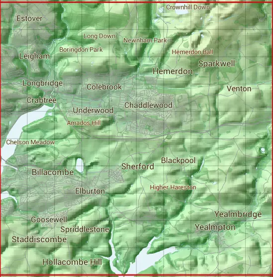
The SX55 10 square kilometre grid intersects with the settlements of Billacombe,Brixton,Down Thomas,Hemerdon,Hollacombe Hill,Lee Mill,Lutton,Plymouth,Sherford,Sparkwell,Staddiscombe,Yealmbridge,Yealmpton & Yondertown.
SX55
SX55 is within the post towns of Ivybridge, Devon & Plymouth, Devon.
The square is within City of Plymouth & South Hams District councils.
The SX55 national grid square measures 10 km by 10 km and has an area of 1,000 kilometres squared.
The technical term for a 10 km map square is a Hectad.
When this 10 km square is divided into a grid 10 by 10 it gives the next size of grid square. This unit is called a Monad and measures 1km square. 100 monads fit in a 10km square.
Out of the monads generated from square SX55, 1313 are land and -1213 are sea. Sea squares are disregarded on this site as they contain no land features.
|
|
|
|
|
|
 |
|
|
|
|
|
 |  |  |  |  |  |  |  |  |  |
 |  |  |  |  |  |  |  |  |  |
 |  |  |  |  |  |  |  |  |  |
 |  |  |  |  |  |  |  |  |  |
 |  |  |  |  |  |  |  |  |  |
 |  |  |  |  |  |  |  |  |  |
 |  |  |  |  |  |  |  |  |  |
 |  |  |  |  |  |  |  |  |  |
 |  |  |  |  |  |  |  |  |  |
 |  |  |  |  |  |  |  |  |  |
| Corner | Latitude | Longitude | Easting | Northing |
|---|---|---|---|---|
| South West Corner | 50.330771 | -4.112902 | 250000 | 50000 |
| South East Corner | 50.330771 | -3.968500 | 260000 | 50000 |
| North West Corner | 50.423113 | -4.112902 | 250000 | 60000 |
| North East Corner | 50.423113 | -3.968500 | 260000 | 60000 |