Search for Grid Square by Postcode
ST00
Based in the South West English Region.
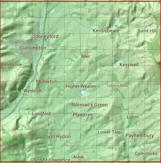
The ST00 10 square kilometre grid intersects with the settlements of Bradninch,Broadhembury,Clyst Hydon,Clyst St Lawrence,Cullompton,Dulford,Kentisbeare,Kerswell,Langford,Norman's Green,Payhembury,Plymtree,Stoneyford & Willand.
ST00
ST00 is within the post towns of Cullompton, Devon, Exeter, Devon & Honiton, Devon.
The square is within East Devon District & Mid Devon District councils.
The ST00 national grid square measures 10 km by 10 km and has an area of 1,000 kilometres squared.
The technical term for a 10 km map square is a Hectad.
When this 10 km square is divided into a grid 10 by 10 it gives the next size of grid square. This unit is called a Monad and measures 1km square. 100 monads fit in a 10km square.
Out of the monads generated from square ST00, 1814 are land and -1714 are sea. Sea squares are disregarded on this site as they contain no land features.
|
|
|
|
|
|
 |
|
|
|
|
|
 |  |  |  |  |  |  |  |  |  |
 |  |  |  |  |  |  |  |  |  |
 |  |  |  |  |  |  |  |  |  |
 |  |  |  |  |  |  |  |  |  |
 |  |  |  |  |  |  |  |  |  |
 |  |  |  |  |  |  |  |  |  |
 |  |  |  |  |  |  |  |  |  |
 |  |  |  |  |  |  |  |  |  |
 |  |  |  |  |  |  |  |  |  |
 |  |  |  |  |  |  |  |  |  |
| Corner | Latitude | Longitude | Easting | Northing |
|---|---|---|---|---|
| South West Corner | 50.790904 | -3.422852 | 300000 | 100000 |
| South East Corner | 50.790904 | -3.278285 | 310000 | 100000 |
| North West Corner | 50.882449 | -3.422852 | 300000 | 110000 |
| North East Corner | 50.882449 | -3.278285 | 310000 | 110000 |