Search for Grid Square by Postcode
SO08
Based in the Mid and West Wales region of Scotland.
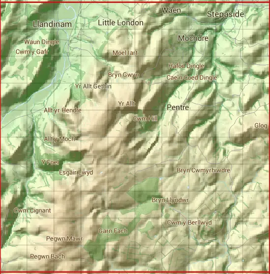
The SO08 10 square kilometre grid intersects with the settlements of Llandinam,Stepaside & Y Drenewydd.
SO08
SO08 is within the post towns of Knighton, Radnorshire, Llandinam, Montgomeryshire, Llandrindod Wells, Radnorshire, Llanidloes, Montgomeryshire & Newtown, Montgomeryshire.
The square is within Powys - Powys council.
The SO08 national grid square measures 10 km by 10 km and has an area of 1,000 kilometres squared.
The technical term for a 10 km map square is a Hectad.
When this 10 km square is divided into a grid 10 by 10 it gives the next size of grid square. This unit is called a Monad and measures 1km square. 100 monads fit in a 10km square.
Out of the monads generated from square SO08, 523 are land and -423 are sea. Sea squares are disregarded on this site as they contain no land features.
|
|
|
|
|
|
 |
|
|
|
|
|
 |  |  |  |  |  |  |  |  |  |
 |  |  |  |  |  |  |  |  |  |
 |  |  |  |  |  |  |  |  |  |
 |  |  |  |  |  |  |  |  |  |
 |  |  |  |  |  |  |  |  |  |
 |  |  |  |  |  |  |  |  |  |
 |  |  |  |  |  |  |  |  |  |
 |  |  |  |  |  |  |  |  |  |
 |  |  |  |  |  |  |  |  |  |
 |  |  |  |  |  |  |  |  |  |
| Corner | Latitude | Longitude | Easting | Northing |
|---|---|---|---|---|
| South West Corner | 52.408847 | -3.474512 | 300000 | 280000 |
| South East Corner | 52.408847 | -3.324547 | 310000 | 280000 |
| North West Corner | 52.500462 | -3.474512 | 300000 | 290000 |
| North East Corner | 52.500462 | -3.324547 | 310000 | 290000 |