Search for Grid Square by Postcode
SE12
Based in the Yorkshire and the Humber English Region.
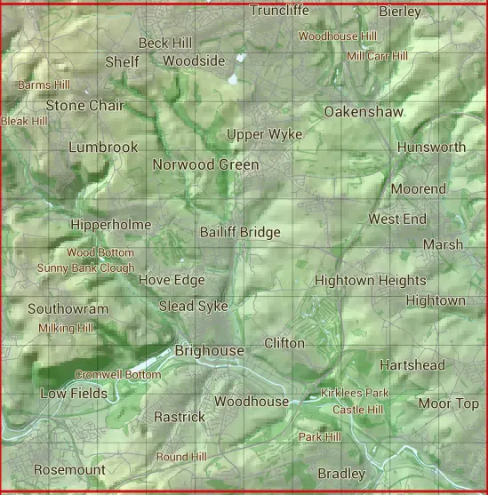
The SE12 10 square kilometre grid intersects with the settlements of Birkenshaw,Blackley,Bradford,Brighouse,Cleckheaton,Coley,Colne Bridge,Drub,Elland,Elland Lower Edge,Elland Upper Edge,Gomersal,Halifax,Huddersfield,Liversedge,Low Bentley,Lower Shelf,Lumbrook,Mirfield,Moor Top,Northowram,Norwood Green,Oakenshaw,Queensbury,Scholes,Shelf,Stone Chair,Stump Cross & Thornhills.
SE12
SE12 is within the post towns of Bradford, Yorkshire, Brighouse, Yorkshire, Cleckheaton, Yorkshire, Elland, Yorkshire, Halifax, Yorkshire, Huddersfield, Yorkshire, Liversedge, Yorkshire & Mirfield, Yorkshire.
The square is within Bradford District, Calderdale District & Kirklees District councils.
The SE12 national grid square measures 10 km by 10 km and has an area of 1,000 kilometres squared.
The technical term for a 10 km map square is a Hectad.
When this 10 km square is divided into a grid 10 by 10 it gives the next size of grid square. This unit is called a Monad and measures 1km square. 100 monads fit in a 10km square.
Out of the monads generated from square SE12, 523 are land and -423 are sea. Sea squares are disregarded on this site as they contain no land features.
|
|
|
|
|
|
 |
|
|
|
|
|
 |  |  |  |  |  |  |  |  |  |
 |  |  |  |  |  |  |  |  |  |
 |  |  |  |  |  |  |  |  |  |
 |  |  |  |  |  |  |  |  |  |
 |  |  |  |  |  |  |  |  |  |
 |  |  |  |  |  |  |  |  |  |
 |  |  |  |  |  |  |  |  |  |
 |  |  |  |  |  |  |  |  |  |
 |  |  |  |  |  |  |  |  |  |
 |  |  |  |  |  |  |  |  |  |
| Corner | Latitude | Longitude | Easting | Northing |
|---|---|---|---|---|
| South West Corner | 53.676104 | -1.850097 | 410000 | 420000 |
| South East Corner | 53.676104 | -1.698079 | 420000 | 420000 |
| North West Corner | 53.766269 | -1.850097 | 410000 | 430000 |
| North East Corner | 53.766269 | -1.698079 | 420000 | 430000 |