Search for Grid Square by Postcode
NX43
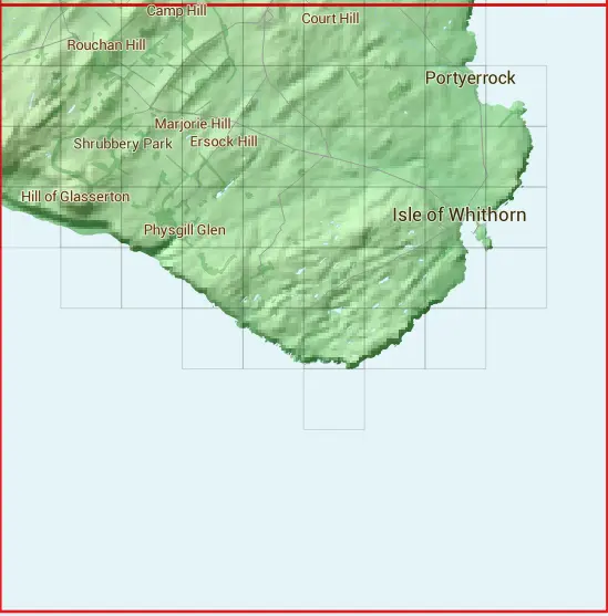
Based in the South Scotland region of Scotland.
The NX43 10 square kilometre grid intersects with the settlements of Isle of Whithorn & Whithorn.
NX43
NX43 is within the post town of Newton Stewart, Wigtownshire.
The square is within Dumfries and Galloway council.
The NX43 national grid square measures 10 km by 10 km and has an area of 1,000 kilometres squared.
The technical term for a 10 km map square is a Hectad.
When this 10 km square is divided into a grid 10 by 10 it gives the next size of grid square. This unit is called a Monad and measures 1km square. 100 monads fit in a 10km square.
Out of the monads generated from square NX43, 192 are land and -92 are sea. Sea squares are disregarded on this site as they contain no land features.
|
|
|
|
|
|
 |
|
 |  |  |  |  |  |  |  | ||
 |  |  |  |  |  |  |  |  | |
 |  |  |  |  |  |  |  |  | |
 |  |  |  |  |  |  |  |  | |
 |  |  |  |  |  |  |  | ||
 |  |  |  |  | |||||
 | |||||||||
| Corner | Latitude | Longitude | Easting | Northing |
|---|---|---|---|---|
| South West Corner | 54.639681 | -4.486235 | 240000 | 530000 |
| South East Corner | 54.639681 | -4.325948 | 250000 | 530000 |
| North West Corner | 54.732545 | -4.486235 | 240000 | 540000 |
| North East Corner | 54.732545 | -4.325948 | 250000 | 540000 |
1 KM Squares within the NX43 10 KM Square
NX4036 NX4037 NX4038 NX4039 NX4135 NX4136 NX4137 NX4138 NX4139 NX4235 NX4236 NX4237 NX4238 NX4239 NX4334 NX4335
NX4336 NX4337 NX4338 NX4339 NX4434 NX4435 NX4436 NX4437 NX4438 NX4439 NX4533 NX4534 NX4535 NX4536 NX4537 NX4538