Search for Grid Square by Postcode
NT42
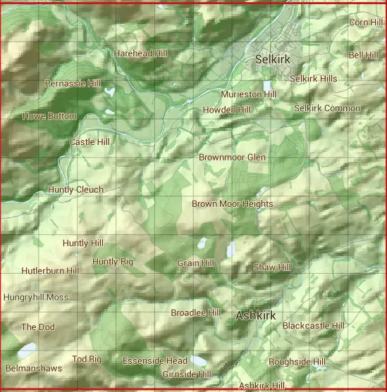
Based in the South Scotland region of Scotland.
The NT42 10 square kilometre grid intersects with the settlements of Ashkirk,Selkirk & Yarrowford.
NT42
NT42 is within the post towns of Hawick, Roxburghshire, Melrose, Roxburghshire & Selkirk, Selkirkshire.
The square is within Scottish Borders council.
The NT42 national grid square measures 10 km by 10 km and has an area of 1,000 kilometres squared.
The technical term for a 10 km map square is a Hectad.
When this 10 km square is divided into a grid 10 by 10 it gives the next size of grid square. This unit is called a Monad and measures 1km square. 100 monads fit in a 10km square.
Out of the monads generated from square NT42, 493 are land and -393 are sea. Sea squares are disregarded on this site as they contain no land features.
|
|
|
|
|
|
 |
|
|
|
|
|
 |  |  |  |  |  |  |  |  |  |
 |  |  |  |  |  |  |  |  |  |
 |  |  |  |  |  |  |  |  |  |
 |  |  |  |  |  |  |  |  |  |
 |  |  |  |  |  |  |  |  |  |
 |  |  |  |  |  |  |  |  |  |
 |  |  |  |  |  |  |  |  |  |
 |  |  |  |  |  |  |  |  |  |
 |  |  |  |  |  |  |  |  |  |
 |  |  |  |  |  |  |  |  |  |
| Corner | Latitude | Longitude | Easting | Northing |
|---|---|---|---|---|
| South West Corner | 55.470133 | -2.952803 | 340000 | 620000 |
| South East Corner | 55.470133 | -2.792475 | 350000 | 620000 |
| North West Corner | 55.561104 | -2.952803 | 340000 | 630000 |
| North East Corner | 55.561104 | -2.792475 | 350000 | 630000 |