Search for Grid Square by Postcode
NO69
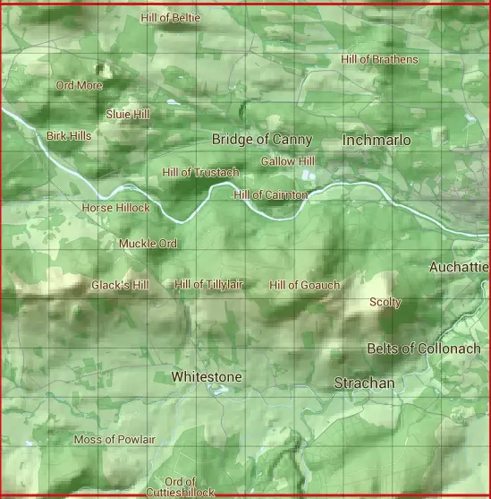
Based in the North East Scotland region of Scotland.
The NO69 10 square kilometre grid intersects with the settlements of Banchory,Finzean,Inchmarlo & Strachan.
NO69
NO69 is within the post towns of Aboyne, Aberdeenshire & Banchory, Kincardineshire.
The square is within Aberdeenshire council.
The NO69 national grid square measures 10 km by 10 km and has an area of 1,000 kilometres squared.
The technical term for a 10 km map square is a Hectad.
When this 10 km square is divided into a grid 10 by 10 it gives the next size of grid square. This unit is called a Monad and measures 1km square. 100 monads fit in a 10km square.
Out of the monads generated from square NO69, 438 are land and -338 are sea. Sea squares are disregarded on this site as they contain no land features.
|
|
|
|
|
|
 |
|
|
|
|
|
 |  |  |  |  |  |  |  |  |  |
 |  |  |  |  |  |  |  |  |  |
 |  |  |  |  |  |  |  |  |  |
 |  |  |  |  |  |  |  |  |  |
 |  |  |  |  |  |  |  |  |  |
 |  |  |  |  |  |  |  |  |  |
 |  |  |  |  |  |  |  |  |  |
 |  |  |  |  |  |  |  |  |  |
 |  |  |  |  |  |  |  |  |  |
 |  |  |  |  |  |  |  |  |  |
| Corner | Latitude | Longitude | Easting | Northing |
|---|---|---|---|---|
| South West Corner | 56.999407 | -2.661663 | 360000 | 790000 |
| South East Corner | 56.999407 | -2.495468 | 370000 | 790000 |
| North West Corner | 57.089995 | -2.661663 | 360000 | 800000 |
| North East Corner | 57.089995 | -2.495468 | 370000 | 800000 |