Search for Grid Square by Postcode
NO15
Based in the Mid Scotland and Fife region of Scotland & North East Scotland region of Scotland.
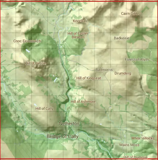
The NO15 10 square kilometre grid intersects with the settlement of Bridge of Cally.
NO15
NO15 is within the post towns of Blairgowrie, Perthshire & Dunkeld, Perthshire.
The square is within Angus & Perth and Kinross councils.
The NO15 national grid square measures 10 km by 10 km and has an area of 1,000 kilometres squared.
The technical term for a 10 km map square is a Hectad.
When this 10 km square is divided into a grid 10 by 10 it gives the next size of grid square. This unit is called a Monad and measures 1km square. 100 monads fit in a 10km square.
Out of the monads generated from square NO15, 412 are land and -312 are sea. Sea squares are disregarded on this site as they contain no land features.
|
|
|
|
|
|
 |
|
|
|
|
|
 |  |  |  |  |  |  |  |  |  |
 |  |  |  |  |  |  |  |  |  |
 |  |  |  |  |  |  |  |  |  |
 |  |  |  |  |  |  |  |  |  |
 |  |  |  |  |  |  |  |  |  |
 |  |  |  |  |  |  |  |  |  |
 |  |  |  |  |  |  |  |  |  |
 |  |  |  |  |  |  |  |  |  |
 |  |  |  |  |  |  |  |  |  |
 |  |  |  |  |  |  |  |  |  |
| Corner | Latitude | Longitude | Easting | Northing |
|---|---|---|---|---|
| South West Corner | 56.633143 | -3.472257 | 310000 | 750000 |
| South East Corner | 56.633143 | -3.305793 | 320000 | 750000 |
| North West Corner | 56.724773 | -3.472257 | 310000 | 760000 |
| North East Corner | 56.724773 | -3.305793 | 320000 | 760000 |