Search for Grid Square by Postcode
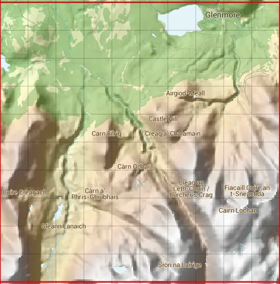
NH90
Based in the Highlands and Islands region of Scotland & North East Scotland region of Scotland.
NH90
NH90 is within the post towns of Aviemore, Inverness-shire, Ballater, Aberdeenshire, Ballindalloch, Banffshire & Kingussie, Inverness-shire.
The square is within Aberdeenshire, Highland & Moray councils.
The NH90 national grid square measures 10 km by 10 km and has an area of 1,000 kilometres squared.
The technical term for a 10 km map square is a Hectad.
When this 10 km square is divided into a grid 10 by 10 it gives the next size of grid square. This unit is called a Monad and measures 1km square. 100 monads fit in a 10km square.
Out of the monads generated from square NH90, 480 are land and -380 are sea. Sea squares are disregarded on this site as they contain no land features.
|
|
|
|
|
|
 |
|
|
|
|
|
 |  |  |  |  |  |  |  |  |  |
 |  |  |  |  |  |  |  |  |  |
 |  |  |  |  |  |  |  |  |  |
 |  |  |  |  |  |  |  |  |  |
 |  |  |  |  |  |  |  |  |  |
 |  |  |  |  |  |  |  |  |  |
 |  |  |  |  |  |  |  |  |  |
 |  |  |  |  |  |  |  |  |  |
 |  |  |  |  |  |  |  |  |  |
 |  |  |  |  |  |  |  |  |  |
| Corner | Latitude | Longitude | Easting | Northing |
|---|---|---|---|---|
| South West Corner | 57.077815 | -3.820656 | 290000 | 800000 |
| South East Corner | 57.077815 | -3.651370 | 300000 | 800000 |
| North West Corner | 57.169890 | -3.820656 | 290000 | 810000 |
| North East Corner | 57.169890 | -3.651370 | 300000 | 810000 |