Search for Grid Square by Postcode
NH82
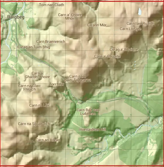
Based in the Highlands and Islands region of Scotland.
The NH82 10 square kilometre grid intersects with the settlements of Drochaid Chà rr & Tomatin.
NH82
NH82 is within the post towns of Boat Of Garten, Inverness-shire, Carrbridge, Inverness-shire, Inverness, Inverness-shire, Kingussie, Inverness-shire & Nairn, Nairnshire.
The square is within Highland council.
The NH82 national grid square measures 10 km by 10 km and has an area of 1,000 kilometres squared.
The technical term for a 10 km map square is a Hectad.
When this 10 km square is divided into a grid 10 by 10 it gives the next size of grid square. This unit is called a Monad and measures 1km square. 100 monads fit in a 10km square.
Out of the monads generated from square NH82, 492 are land and -392 are sea. Sea squares are disregarded on this site as they contain no land features.
|
|
|
|
|
|
 |
|
|
|
|
|
 |  |  |  |  |  |  |  |  |  |
 |  |  |  |  |  |  |  |  |  |
 |  |  |  |  |  |  |  |  |  |
 |  |  |  |  |  |  |  |  |  |
 |  |  |  |  |  |  |  |  |  |
 |  |  |  |  |  |  |  |  |  |
 |  |  |  |  |  |  |  |  |  |
 |  |  |  |  |  |  |  |  |  |
 |  |  |  |  |  |  |  |  |  |
 |  |  |  |  |  |  |  |  |  |
| Corner | Latitude | Longitude | Easting | Northing |
|---|---|---|---|---|
| South West Corner | 57.254867 | -3.995600 | 280000 | 820000 |
| South East Corner | 57.254867 | -3.825084 | 290000 | 820000 |
| North West Corner | 57.347165 | -3.995600 | 280000 | 830000 |
| North East Corner | 57.347165 | -3.825084 | 290000 | 830000 |