Search for Grid Square by Postcode
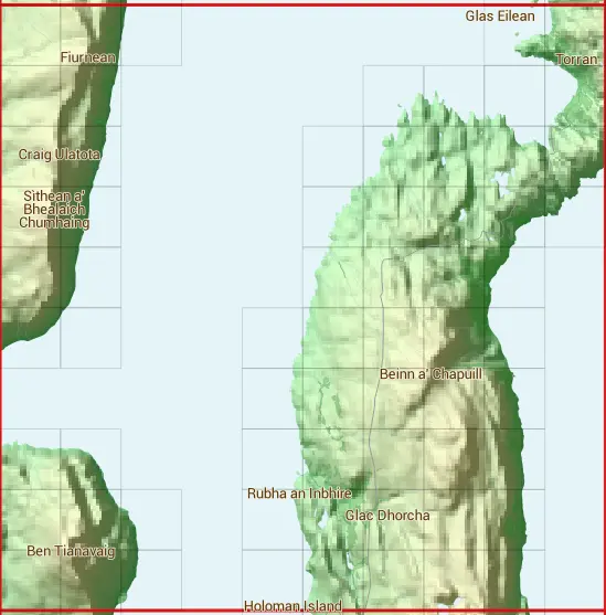
NG54
Based in the Highlands and Islands region of Scotland.
NG54
NG54 is within the post towns of Kyle, Ross-shire & Portree, Isle Of Skye.
The square is within Highland council.
The NG54 national grid square measures 10 km by 10 km and has an area of 1,000 kilometres squared.
The technical term for a 10 km map square is a Hectad.
When this 10 km square is divided into a grid 10 by 10 it gives the next size of grid square. This unit is called a Monad and measures 1km square. 100 monads fit in a 10km square.
Out of the monads generated from square NG54, 331 are land and -231 are sea. Sea squares are disregarded on this site as they contain no land features.
|
|
|
|
|
|
 |
|
|
|
|
|
 |  |  |  |  | |||||
 |  |  |  |  |  | ||||
 |  |  |  |  |  |  | |||
 |  |  |  |  |  |  | |||
 |  |  |  |  |  | ||||
 |  |  |  |  |  |  | |||
 |  |  |  |  | |||||
 |  |  |  |  |  |  | |||
 |  |  |  |  |  |  |  | ||
 |  |  |  |  |  |  |  |
| Corner | Latitude | Longitude | Easting | Northing |
|---|---|---|---|---|
| South West Corner | 57.381514 | -6.171257 | 150000 | 840000 |
| South East Corner | 57.381514 | -5.995155 | 160000 | 840000 |
| North West Corner | 57.476502 | -6.171257 | 150000 | 850000 |
| North East Corner | 57.476502 | -5.995155 | 160000 | 850000 |
1 KM Squares within the NG54 10 KM Square
NG5040 NG5041 NG5042 NG5044 NG5045 NG5046 NG5047 NG5048 NG5049 NG5140 NG5141 NG5142 NG5144 NG5145 NG5146 NG5147 NG5148 NG5149 NG5240 NG5241 NG5249 NG5440